Regional Ocean Operational Forecast Texas-Louisiana shelf & Gulf of Mexico

People
Downloads
| Attachment | Size |
|---|---|
| TAMU.pdf | 69.33 KB |
| Article-Forecast-model-circulation.pdf | 3.24 MB |
| Article-Nature-communications.pdf | 3.65 MB |
| Abstract-Ocean-Dynamics.pdf | 5.26 MB |
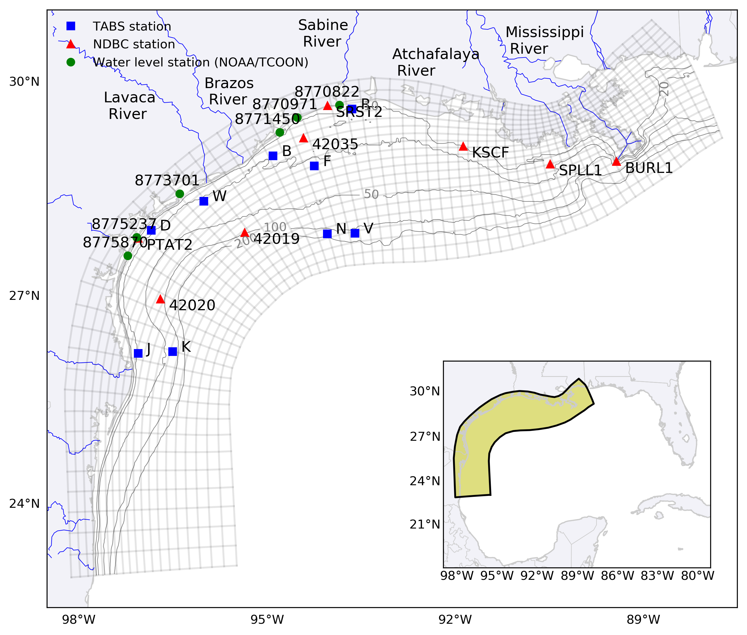
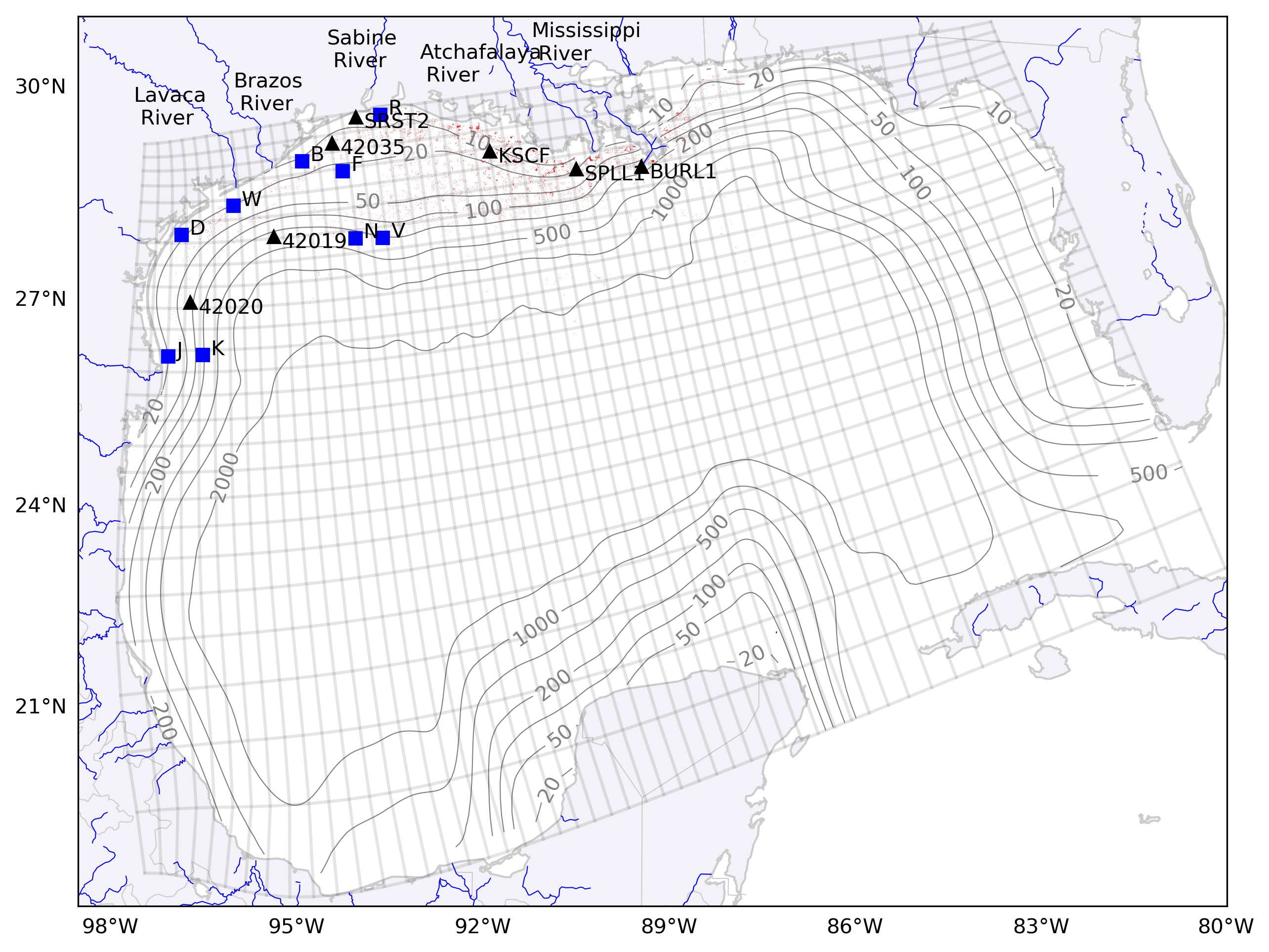
The forecast system is based on Regional Ocean Modeling System (ROMS), which is a hydrostatic primitive-equation ocean model (Shchepetkin and McWilliams, 2005). It’s an open source model and the source code can be obtained through their developer’s website (www.myroms.org). The aim of the system has been to simulate robust ocean circulation of the Texas-Louisiana (TXLA) shelf and Gulf of Mexico (GoM) basin. The domain for the TXLA shelf covers the entire shelf and shelf slopes for the TXLA domain and the GoM domain covers the entire Gulf of Mexico. The model uses a curvilinear orthogonal grid stretching along the curved coastline of Texas and Louisiana horizontally and terrain-following stretching coordinate (s-coordinates) vertically. The spatial resolution is variable. The finest horizontal resolution is approximately 600 m and the coarsest resolution is approximately 4.0 km for the TXLA domain and 3.7 km near the coast and 25 km near the offshore boundary for the GoM domain. The number of vertical layers is 30 and 20, respectively. The TXLA forecast is full 3-D model without tides and the GoM forecast only includes winds and tides as forcing (i.e. no density change).
The forecast system as we call Regional Ocean Operational Forecast System (ROOFS) is based on a series of python and shell programs. It’s similar to the previous incarnation, OOF (Operational Ocean Forecast Engine for Python) (Marta-almeida et al., 2011), but is completely a different system. The main difference is that the new forecast system can accommodate virtually infinite number of forecasts and different models as opposed to one forecast by OOF. Both forecast systems download all necessary input data from external sources and processes the data to create files necessary for the forecast and nowcast runs, submits a job on a HPC cluster, and processes the forecast and nowcast outputs for visualization and other purposes. The necessary input data to download include NOAA’s Global Forecast System (GFS), Global HYCOM, streamflow data from NOAA’s National Water Model. These external data sets are applicable for any parts of the world ocean except the streamflow. Additional external data can be added to your area of interest by adding additional scripts to process streamflow and other external data sets (e.g. high-resolution meteorological data). We provide a 4-day forecast and 1-day nowcast. The forecast and nowcast are each scheduled to run and once external data all become available, the system submits a jobs on one of the Texas A&M’s HPC clusters. Usually, the forecast update will be complete before 9 AM CST (US Central Time) and the nowcast update will be complete in the early morning of the next day. Both provide hourly output data for visualization and distribution on public domain. There are various error-checking routines in place to ensure the robustness of the system. Currently, full 3-D Texas-Louisiana shelf forecast and barotropic Gulf of Mexico forecast are operational.
Ocean prediction for the Texas-Louisiana shelf is complex due to large volume of freshwater input from the Mississippi and Atchafalaya rivers, which creates fronts and associated instabilities, making the prediction more difficult. However, our TXLA forecast demonstrates its ability to predict salinity variability and associated dynamics, which are detailed in the papers we published. The forecast output is freely distributed through various distribution channels including THREDDS servers (https://gcoos5.geos.tamu.edu/thredds/catalog.html), NOAA IOOS model viewer (https://eds.ioos.us/map/), and NOAA GOODS (https://gnome.orr.noaa.gov/goods).


Follow us